

The Local newsletter is your free, daily guide to life in Colorado. For locals, by locals.
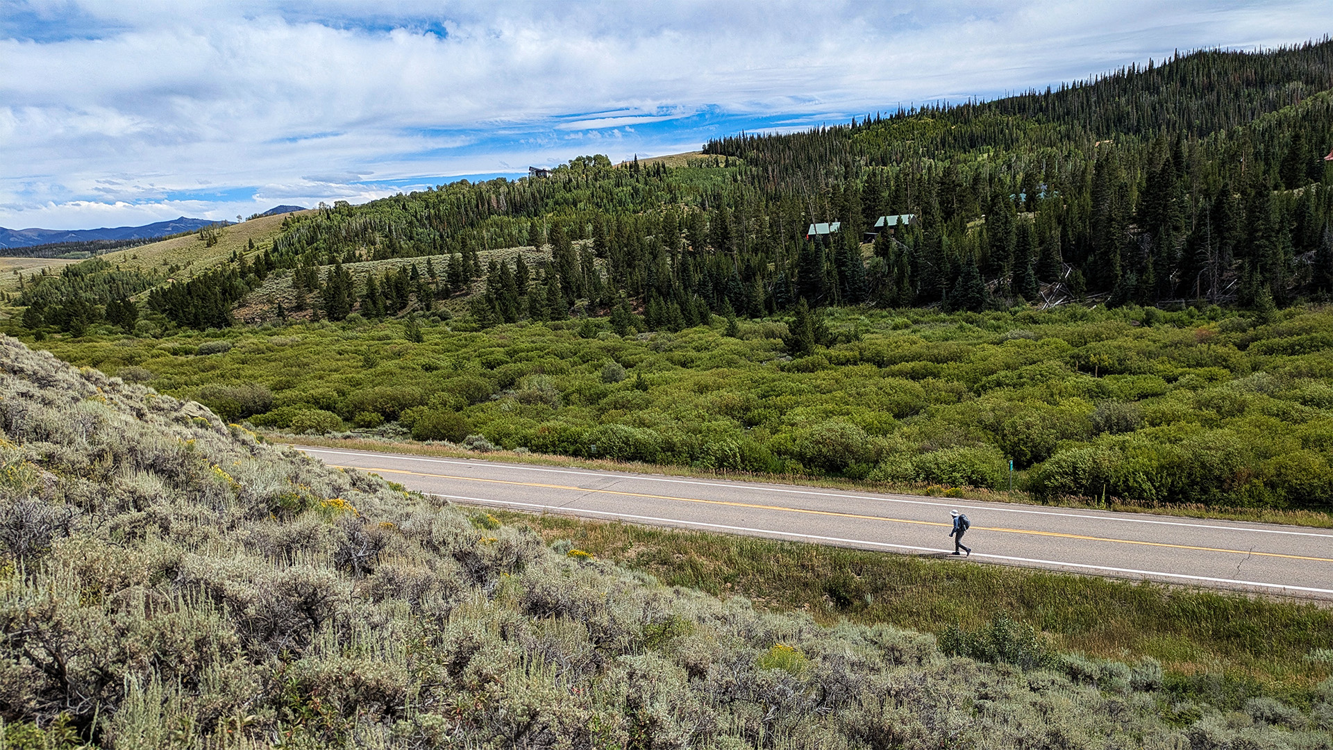
One September morning in 2024, Karl Luce laced up his boots, shouldered his Hyperlite backpack, and hiked to the pavement. He’d been dreading this day. The Continental Divide Trail, which had been leading him down a quiet dirt road in North Park’s wide-open scrublands between Steamboat Springs and Kremmling for 18 miles, abruptly dead-ended at CO 14. A semi barreled past. Luce tightened his wide-brimmed sun hat under his chin and started walking.
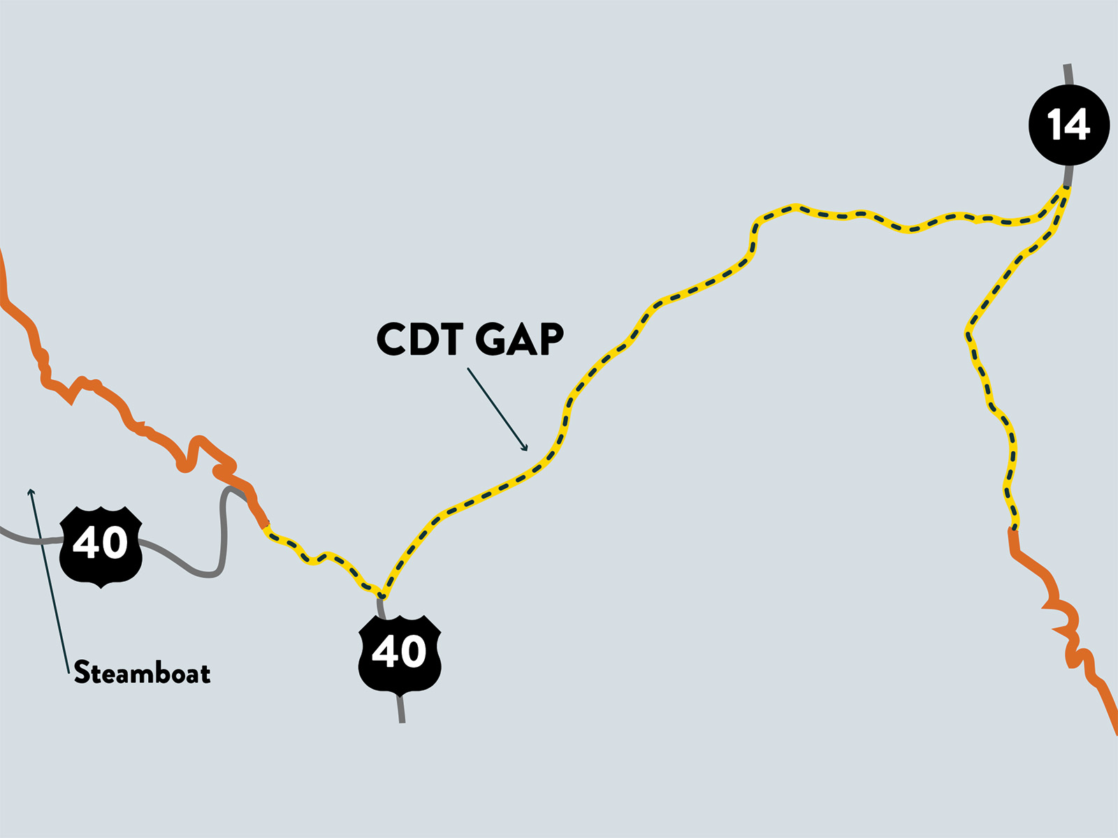
He, like all northbound CDT thru-hikers before him, trekked southwest along the highway’s narrow shoulder for nine miles, wincing whenever a car whooshed past at 55 mph—at least once every minute. Peter Gabriel’s “Make Tomorrow” looped through his earbuds, and his footsteps fell into rhythm with the song’s dreamy cadence. When Luce hit Muddy Pass, a gentle, 8,772-foot passage over the Divide at the junction with U.S. 40, he still had two miles of road-walking to go. Finally, after five hours of tracing the highway, Luce’s boots hit soil again as the CDT veered north on the unpaved Forest Road 308.1. In a few more miles, he’d be back on an actual trail in the Medicine Bow-Routt National Forest, en route to Canada.

“It’s probably the scariest road walk I’ve done,” says the experienced distance hiker from Bellingham, Washington, who’s been section-hiking the 3,100-mile CDT, a border-to-border trail that winds through five states, in large chunks since 2022. “It’s just mile after mile, traffic buzzing by your head.”
That 11-mile highway walk in north-central Colorado, known to thru-hikers as the Muddy Pass Gap, is boring at best, dangerous at worst. It’s flat, treeless, and totally exposed to the sun and thunderstorms. It is not what any hiker pictures when they imagine completing one of the country’s wildest, most rugged routes. And it’s the only place in Colorado where CDT hikers have to pound the pavement.
Advocates have been trying to reroute the long path off the highway for decades. Now—after years of on-the-ground scouting, public meetings, and bureaucratic wrangling—a coalition of unlikely partners thinks it has finally found a way through. Its prize is deceptively small: just 11 miles. But if this loose partnership succeeds, it will do more than eliminate one of the CDT’s most notorious road walks. It will complete Colorado’s entire 750-mile stretch of the trail, creating an unbroken route from New Mexico to Wyoming.
Read More: The Epic Battle Over Who Will Be Able To Use a Proposed Backcountry Trail
Hikers had been dreaming of a recreational route that would follow the Continental Divide for years before it came to be. Similarly ambitious footpaths, the Appalachian Trail and Pacific Crest Trail, had been in existence for decades by the time CDT boosters (including volunteers from the Rocky Mountain Trails Association and the Colorado Mountain Club) got to work in the early 1960s. The trail would trace the U.S. portion of North America’s spine—the geographic boundary line between the Pacific and Atlantic watersheds that runs from New Mexico to Montana. As a 1977 Department of the Interior study examining the feasibility of such a path put it, the 3,100-mile route traversed “some of the most spectacular scenery in the United States.”
But national scenic trails don’t just appear on the landscape fully formed. They stitch together many paths already in existence on public lands, leaving gaps where roads must be used until new trail can be built. In that way, the CDT has been a work in progress since it was officially designated a national scenic trail in 1978, says Jordan Williams, the Colorado regional representative for the Continental Divide Trail Coalition, the trail’s nonprofit partner. “When the CDT was officially designated, it was defining a corridor,” he notes, “but not necessarily a completed trail. With a 3,000-mile-long trail, it’s going to be almost impossible to ground-truth it 100 percent.” The nitty-gritty of plotting every last mile was left to local land managers.
“It was, ‘Let’s establish the route, let’s put it in the most optimal location that we have available to use,’ ” says Ben Lara, the U.S. Forest Service administrator who oversees the CDT. “Then, over time, we work on putting it in the most ideal location.”
About a quarter of the CDT’s scenery belongs to Colorado, where the path averages 10,000 feet in elevation and traverses 11 wilderness areas; highlights include 14,270-foot Grays Peak (the trail’s high point), the dramatic Collegiate Peaks, and the alpine tundra of Rocky Mountain National Park. In other words, the road walk at Muddy Pass Gap isn’t exactly on-brand. “You picture snowcapped peaks and all these amazing scenes along the CDT, and here we are in Colorado, showcasing that with 11 miles of pavement,” says Doug Vilsack, the former Colorado state director for the Bureau of Land Management. (He stepped down in March.)
Muddy Pass Gap isn’t the only remaining road walk. The CDT Coalition estimates only 69 percent of the trail is set, leaving about 160 miles of highway, most of which are in New Mexico. In Colorado, there are just the 11 at Muddy Pass Gap. There’s no rule that says thru-hikers can’t skip asphalt sections, and many hitchhike past them. But purists insist on suffering through for the sake of completing the entire official route—called “redlining.” “It’s a series of connected footsteps,” Luce says.“If you want to experience the whole landscape, then you don’t skip anything.”
The job of figuring out how to solve the Muddy Pass Gap problem has essentially fallen to one person: Dan Carter. Every July or August for the past six years, the CDT Coalition trails and conservation manager has come to Muddy Pass from his home in southern New Mexico to scout possible locations for rerouting the CDT off the highway. In practice, that means 15-hour days of off-trail hiking, followed by collapsing for the night at a remote campsite before doing it all again the next day.
This happens in mud and bug season in riparian North Park, north of Walden. “It can go from a fairly pleasant hike through the forest to just muck and impenetrable ponds, with mosquitos swarming you,” Carter says. “But then there’s wildflowers, too.” (Disclosure: Carter is the partner of the author’s sister-in-law.)
Real progress on Muddy Pass Gap began when the CDT Coalition, which does everything from rallying volunteers for trail work to fundraising to publishing free, detailed trail guides for hikers, hired Carter in 2019 to focus on the reroute. To do that, he started with the map, identifying “control points”: attractive spots to include on the reroute (like existing trails, water sources, or great views) and points to avoid (like cliffs or sensitive wildlife habitat). “With that, you can start to look at your maps and whittle things down to possibilities,” Carter says. Then he headed out on the landscape to see if what looked good on paper would actually work in three dimensions. Sometimes an old trail on the map wouldn’t exist anymore. Sometimes he’d find impassable slopes that fell between topo lines. Carter kept the intangibles in mind, too. He made a point to explore the landscape during different times of day and even moods. “Lighting can really showcase things that you didn’t notice on previous visits,” he says.
He, and occasionally the CDT Coalition’s Williams or other interested parties, hiked at least two miles for every potential mile of trail reroute, meticulously logging notes, saving waypoints in multiple mapping apps, and snapping geolocated photos. He’d take his findings back to regular working group meetings, where everyone from land managers to locals would weigh in. And then he’d return to the map. Repeat for six years.
As it turns out, a lot of people care about what happens with the CDT at Muddy Pass. The CDT Coalition’s working group, which it assembled in 2019, includes many stakeholders: the Forest Service, the Bureau of Land Management, the Colorado State Land Board, Colorado Parks & Wildlife, the Colorado Department of Transportation, the nonprofit Trust for Public Lands, the Colorado Cattlemen’s Agricultural Land Trust, and Jackson County among them. Perhaps it’s no wonder nearly five decades have passed without a clear solution.
One major challenge: The high-elevation, sagebrush-dominated area is primo wildlife habitat. More than 5,000 elk call North Park home, and Muddy Pass Gap slices right through an important range for both winter and calving. Mule deer and pronghorn migrate across the area, too, and the landscape is ideal for greater sage grouse and the endangered and threatened Columbian sharp-tailed grouse. Existing highways already disrupt these sensitive areas, and biologists worry new hiking trails would further squeeze wildlife. “It really is a special place, and we don’t want to invite a lot of additional use that would disturb quality of life for the animals,” Williams says.
Private property lining the highway around Muddy Pass has also proved to be a significant hurdle. “If there was a public land corridor to put the trail on, we would have solved it a while ago,” Williams says. Having government agencies or land trusts buy strategic chunks of private property hasn’t panned out as a solution, either: Land is simply too expensive, or owners aren’t willing to sell. Nor can the federal government invoke eminent domain to acquire private land for the public good (as was done to complete the Appalachian Trail). No legislation authorizes that heavy-handed move for the CDT, and besides, says trail administrator Lara, “That’s just asking for conflict and strife. We strive for finding common ground for where the trail could go.”
That leaves easements—legal permission to use private property for a specific purpose (in this case, hiking). They’re common tools nationwide for negotiating these kinds of trail-routing dilemmas and have been used many times in Colorado, but thus far, they’ve proven elusive at Muddy Pass, where the CDT Coalition has approached numerous landowners.
Brad Probst manages an 18,000-acre ranch near the intersection of CO 14 and U.S. 40. He has no issue with the hikers he frequently sees on the highway—far from it. He has occasionally left a cooler by his gate stocked with “trail magic”—free Gatorades, bug spray, and beer, plus a logbook—for passing thru-hikers. “We had more than 75 entries in that journal” one summer, he says. Probst often gives thru-hikers a lift to Steamboat Springs to resupply food (and maybe grab a shower), he says, and many times has invited them into his home to spend the night during stretches of nasty weather. “We’re friendly people out here,” Probst says.
His slice of the big-sky landscape is dotted with stands of evergreen and aspen, and cliffy ridgelines and peaks punctuate the skyline. About seven miles of the Continental Divide snake right through it. There, Probst and his family run an outfitting business for hunters and snowmobilers, plus rent vacation homes, host weddings, and run cattle. “Just having anybody walk through your backyard at any random time, that’s not OK, right?” he says. “The answer is always going to be no.”
Last summer, the CDT Coalition made a “huge breakthrough,” in Carter’s estimation. Primarily to protect elk calving grounds and other sensitive habitat, the team had been zeroing in on a reroute that would move the majority of trail at Muddy Pass Gap farther off the road, mostly within the Colorado Department of Transportation’s right of way (the strip of land along both sides of the highway that the state can access for road maintenance). Several sheer rock features still blocked the route. After multiple conversations, though, two adjacent landowners expressed willingness to allow easements around those obstacles onto their private properties.
Probst was one of them. “We’re not letting them through our land inside the fence,” he says. “But we own some land outside of CDOT’s easement along the highway, and we’re talking about letting [hikers] go through. There isn’t much of a concern there.” Though those sections are still within sight and earshot of the highway at times, the new CDT could be built at a higher elevation for more separation—and a much nicer hiking experience. Carter walked the proposed route, confirming it not only would physically work, but that it also contained topography and trees that screened the road from view. Even better, everyone in the working group signed off on the plan.
“There’s a line on the map,” Carter reports. “We’ve come to a consensus in the working group. We have a route that looks like it will go, and it addresses all of the concerns.” (The CDT Coalition declined to share the new trail map until all paperwork is finalized.)
Muddy Pass Gap isn’t closed yet. The CDT Coalition is now in the thick of the “less sexy phase,” Williams says. That means hammering out an official agreement with CDOT for use of the highway right-of-way and legally setting up the two private land easements. And because the agreed-upon reroute will require building about six miles of new trail, environmental reviews also need to be done (the other five miles can use existing routes but also may need further environmental reviews). Carter likens the monthslong process to closing on a house: With so many people and entities needing to sign off on the plan, it’s bound to take time.
For Carter, the CDT is worth such exacting work. “You’re trying your best to put it in its final home,” he says.
The CDT Coalition is reluctant to make any promises about exact timelines, but Carter and Williams estimate the trail will be fully built and off the road in two to three years, as long as all the legal wrangling goes smoothly. (A boost could come in the form of the Continental Divide National Scenic Trail Completion Act, a bill introduced in the U.S. House by Colorado Representative Joe Neguse. It would direct the Secretary of the Interior and the USDA to prioritize finishing the CDT as a continuous route, including the myriad highway miles in New Mexico, within 10 years of its enactment; the House version of the bill is still sitting in committee, and the Senate version advanced this past December.)
The process for finalizing a simple stretch of trail can feel like a microcosm of democracy itself: iterative, frustrating, slower than anyone would like. But it’s preferable to the alternative. “People have opinions, and seeking consensus can sometimes take more time than some of the other ways that we make decisions,” Lara says. “A big part of these efforts is making sure that we have public engagement and that there’s transparency. That takes time. In the long term, that’s the best way to go about this.”
And when the ink finally dries and the dirt settles, 11 more miles of the Continental Divide Trail will be in place. Just 149 to go.
Read More: 3 Ways To Hike the New 300-Mile Northern Colorado Trail