

The Local newsletter is your free, daily guide to life in Colorado. For locals, by locals.
- Length:
- 4.5 miles (round-trip)
- Difficulty:
- Moderate
- Trailhead:
- Loch Lomond (39.813411378190004, -105.65598293949533)
- Why we love it:
- After a steady climb, you’re rewarded with a day of swimming and sunbathing at a pristine alpine lake.
- When to go:
- April through mid October; the trail becomes icy in the winter
- Pre-hike fuel:
- Stop by the Frothy Cup in Idaho Springs for giant muffins and a candy bar latte.
- Post-hike buzz:
- Wash down a hearty bison burger with an award-winning craft brew at Westbound & Down. The dry-hopped Spirit of the West is a fan favorite.
- Restrooms:
- None
- Dogs:
- Allowed on leash
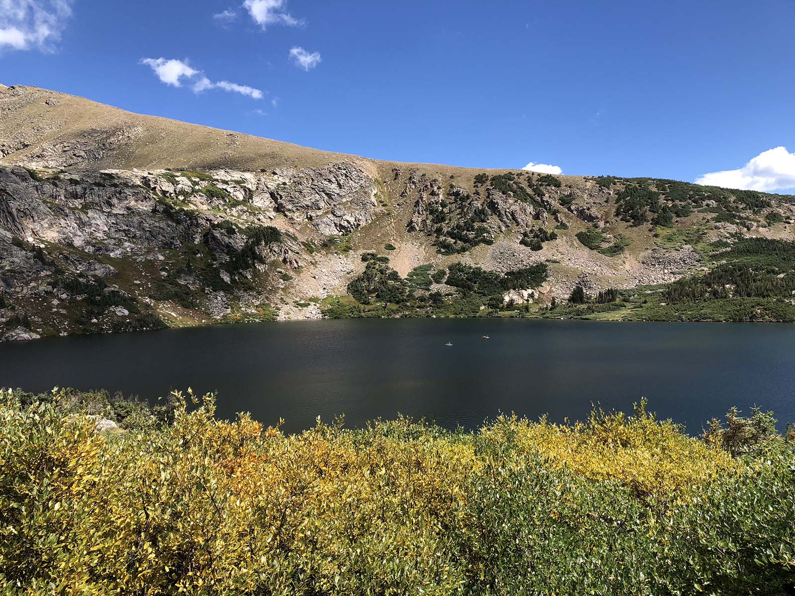
As the aspens start to turn gold, there are still some places where summer refuses to let go. One of them is Loch Lomond in Arapaho National Forest. Meaning lake in Scottish, this hike is often overlooked by hikers seeking out the popular neighboring trail, St. Mary’s Glacier. Although it’s worth seeing, St. Mary’s is almost always crowded, with the parking lot full before 9 a.m. Meanwhile, nearby Loch Lomond is a quieter escape.
The hike starts on a road shared with AWD vehicles. If your car can handle it, the road—which doubles as the trail—goes all the way up to Loch Lomond, making it easier to bring fishing gear and SUP boards to the lake. If you’re off-roading it, be wary of the explorers who aren’t.


For the first mile, the easy-to-follow trail is a steady incline with occasional views of mountaintops. About a mile and a quarter in, the trail opens up to sweeping views of pines and the transitioning aspen trees. Looking down, a stream—flowing from Loch Lomond—trickles down the mountain. If it’s still warm enough, you may spot wild raspberries growing alongside the road. This part of the trail—and the remaining portion—is quite exposed, so wear sun protection.
About a mile and a half in, the trail weaves beneath a canopy of trees. Here, you’ll likely start to see tents scattered throughout the forest. Dispersed camping is permitted on Loch Lomond Trail and there are a surplus of spots tucked away from the main road.

High-altitude wetlands can be seen on the trail’s remaining quarter-mile. A few wildflowers still hang on during the last warmer days of summer. As you approach the end of the road, Loch Lomond appears. If you’ve brought a paddleboard, shove off to get an up-close look at the waterfall. Or, keep climbing another 0.5 mile to explore the two tarns above Loch Lomond—Reynolds and Steuart Lakes—and a bird’s-eye view of your original destination.
Directions: Head west on I-70 and take the Fall River Road exit. Head North on Fall River Road and drive past several large switch backs. Turn left onto Alice Road then right onto Loch Lomond Road. Turn right onto Steuart Road (.3 miles). The trail head will be on your left.